Latitude: 45° 01’ N
Longitude: 14° 03’ E
British Admiralty Chart: 2719
Admiralty Pilot: 47
Time Zone: GMT +1 h
Locode: HRRAS
Raša-Bršica terminal
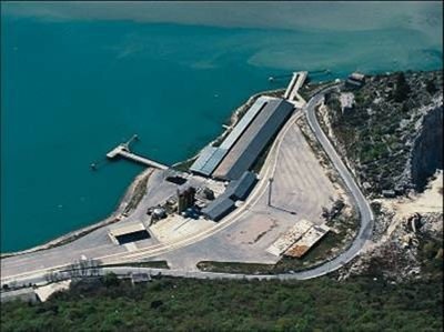
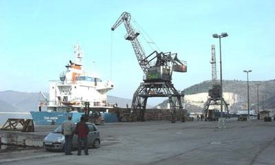
Located in the 11 km long Bay of Rasa SW of Rijeka. As multipurpose terminal situate in Raša basin, equipped for handling general cargo, timber and livestock on the pier and storage facility Štalije (Total area 510,383 m²/covered surface are 35,500 m²). Nowdays, there are good possibilities to redevelop this area and transform it into an attractive terminal facilitiy to offer services for the general cargo handling. There is also enough space, about 150 ha, suitable for developing additional port and industrial facilities. The terminal Bršica is equipped with a suitable infrastructure for loading/discharge of animals (one-time storage capacity of 1,000 heads of cattle), which enables direct movement from one transportation means to another. There is a permanent veterinary inspection available at the terminal.
Anchorage position
- 45° 01’ N
- 14° 03’30 E
- West of cape Trget.
- Depth 14 - 16 m.
Port of Raša-Bršica Pilotage
Compulsory for vessels over 500 GT, boarding place east off Trget harbour, at anchorage position. Available pilotage through Zaliv Rasa from Pt. Ubac to the port (Ship’s option).
- RADIO VHF channel 10 and 16.


